Minnesota is loaded with waterfalls. On the northern tip of Minnesota rests her tallest waterfall. The High Falls of the Pigeon River is a masterpiece! The hike is short and the views stunning at Grand Portage State Park.
Distance: 1 mile Type: Out and back Level: Easy Terrain: Paved/Boardwalk Dog Friendly: Yes, on leash. Time to go: All year Fees:$7 day pass or $35 state park pass
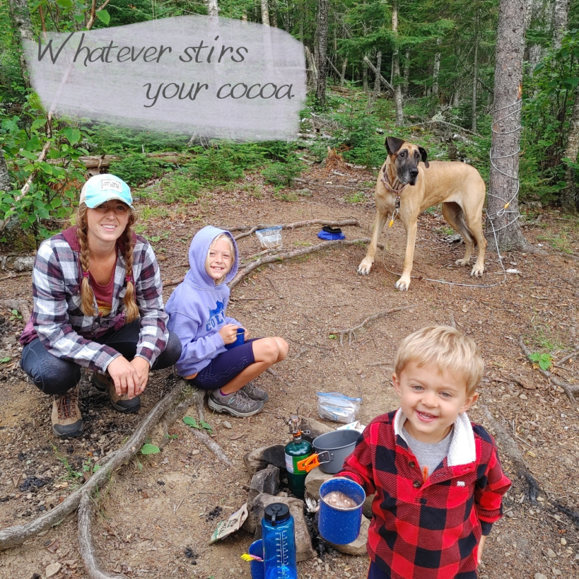
**Note: There are no camping areas at Grand Portage State Park. If you’re interested in camping nearby, try Cascade Falls or George Crosby Manitou.
Parking
Oh Canada! The other side of Pigeon River is Canada. If fact, the parking area is just one left turn before the border. So, if you’ve hit Canada, you’ve gone too far.
The parking area is petite, but we didn’t have trouble finding a spot. The parking area is also close enough to the visitors center and picnic area to bring a lunch and make a day of it.
Visitors Center
Stop in at the visitor’s center before or after your hike to check out the history of the area and Native American information. It’s worth the stop to see the displays. The area is rich in voyager history and Ojibwe culture, also check out Grand Portage National Monument.
Trail Head
The trail starts right at the visitor’s center. The easy to follow and well marked trail with lead the way. Don’t forget to check out the overlook at the beginning of the trail. It’s intriguing to watch the river become more wild the farther upstream you hike.
Terrain
The path to the High Falls is paved, making it stroller and wheel chair friendly. Continuing on the trail to the Middle Falls, however, is not paved and is considered to be a difficult trail.
Given that we had two 10 week old puppies with us, we didn’t tackle the trail to Middle Falls. An adventure for another time, after the dogs gain more experience and stamina.
Pigeon River Banks
Take a side quest on the riverbanks of the Pigeon River. The rocky shore and mini-cascades are worth the pitstop. There are a few turnoffs along the trail. Watch your step and keep little ones in hand. There are no hand rails along the rivers edge once you get down to the shore.
We had a fun time hopping on rocks and exploring the river. The current is strong and water murky, keep kids (and puppies) in sight.
Boardwalk and Steps
Where the pavement ends, the boardwalk begins. All the way up to the falls is wheel chair and stroller accessible. There are a couple of spots with steps for a more grand view of the falls.
The Falls
Stunning!! I am always amazed by waterfall views. Listen to the rushing water before peering over the deck at this cascade. Be mindful of the railings and follow guidelines. Don’t make your attempt at a great picture the last thing you do.
Waterfalls on the Way
Don’t drive all the way to the tip of Minnesota to see just one waterfall! Hit the falls of the North Shore on the way!
Craving a trip to the North Shore but dreading the crowds? Same here! I love the beauty and dramatic landscapes of Minnesota’s North Shore, but those crowds are a huge deterrent. George Crosby is the perfect place to be then.
Distance: 2 Miles Level: Difficult Dog Friendly: Yes, on leash Time to go: Late Spring-Fall Fees:$7 Entrance Fee or $35 Yearly MN State Park Vehicle Pass (totally worth it, get it here.)
Parking
For being a state park with fewer visitors, the parking lot sure stayed full. We didn’t have trouble parking but the lot did seem to always have an abundance of people in it. That being said, we saw very few hikers and campers during our visit. Everyone is very well dispersed.
Middle Trail
Given that there are 24 miles of hiking trails at George Crosby, there are options for getting to the falls. The easiest route is the Middle Trail.
Middle Trail starts at the parking area, there is a clear sign. You’ll pass the pit toilet and continue on until you reach the Manitou River Trail. Once at the Manitou River Trail, take a left. Heading north west, follow the trail to the river bank. The sound of the flowing river can be heard as the trail leads closer to the falls. The hike is really quite simple. Though the terrain can be challenging.
Terrain
The terrain on this trail is not to be taken lightly. There are roots, rocks, steep climbs and descents. It’s really fun! Who doesn’t love a rough trail?! It adds to the adventure. Our four year old traversed this trail with a great attitude and enthusiasm (until it got hot). That being said, I do not recommend this trail for small children or at least have a backpack carrier for the real little adventurers.
Be sure to pack appropriate footwear. We all had our hiking boots/shoes along and definitely needed them. This is not a hike for crocs, leave those in camp or your car. If you have trouble with balance or uneven ground, consider bringing trekking poles or a walking stick.
Unexpected Debris
This is a new one. We saw a wild cooler in it’s natural habitat, haha! It seemed as though someone had just left it and would return shortly. However, on our return trip the cooler was still present and we noticed a broken wheel. We were to curious not to open it, more curious than the bears apparently. The cooler was no longer cool inside, based on the contents of the thawed food items, it had been sitting for a couple of days. You never know what you’ll find on the trail!
Cascade Falls
These falls are absolutely breath taking! The strenuous hike is worth it. Before catching a glimpse of the falls, the rushing water can be heard and it draws hiker in. Watch your footing as you approach the falls. The trail becomes narrow at times with more of a drop than one would like to fall. The rocky edge adjacent to the falls offers plenty of seating the admire the awesome beauty of the falls.
We saw no other hikers on our journey to the falls. This is truly one of the most secluded waterfall hikes I’ve been on in Minnesota. For peace, quiet, and waterfalls, visit the Cascade Falls at George Crosby Manitou State Park.
Venture down to the southeastern tip of Minnesota to Beaver Creek Valley State Park. This whimsical park features an amazing spring fed river with clear waters and trout galore. The trails wind around the valley offering stunning views of the lush hillside and streams.
I was amazed by Minnesota’s bluff country. The dramatic landscapes are amazing. It really proves that Minnesota is beautiful no matter which corner you venture to. It’s not just the North Shore that’s worth a visit.
Hiking Trails & Spring Views
This southern state park hosts only 8 miles of hiking trails. Most of which are contained in the 6+ mile Hiking Club trail. This trail encompasses Beaver Creek Trail, Hole in the Rock Trail, Big Spring Trail, and West Rim Trail. Beaver Creek Valley Trail is the top trail at the park.
Beaver Creek Valley Trail- 3.5 mile loop Plateau Rock Trail-1 mile out & back Hole in the Rock Trail- 1 mile one way Big Spring Trail- .25 miles one way West Rim Trail- 1 mile one way
All of these trails have some kind of river view or creek view. Some of the creeks dry up later in spring and into summer. The river flowing after the spring keeps flowing. Be sure to check out Big Spring Trail for the most tranquil spot in the park, the spring that feeds the river.
Fish for Trout
Fly fisherman enjoy this tranquil stream on a calm morning for fishing brown and brook trout. We are fisherman, but we don’t fly fish. That’s okay, you don’t have to be proficient in fly fishing in order to catch a trout at Beaver Creek. We used our regular fishing rods and some enticing lures. That did the trick!
Combine trout fishing with a hike along the Beaver Creek Valley Trail. There are numerous fishing holes along the way. The largest being at the end of the farthest loop.
Fishing License: All fisherman over the age of 16 must have a fishing license in the state of Minnesota. If you’re fishing in waters with trout, a trout stamp is required.
Camp
Tent, RV, or Hammock! This park has a few options for camping. From an RV area with closer campsites to cart in sites with more tree coverage between, you can choose your seclusion level at Beaver Creek. Sites 27, 34, 38,39, and 42 can accommodate a hammock given the tree size and distance apart. Many of the campsites are near the creek. The sounds of the babbling waters will lull you to sleep… or make you need to visit the restroom.
Birding & Wildlife
Rare migratory birds pass through and nest in the park during the summer months like the warbler and water thrush. Keep a watchful eye while hiking the trails. Wildlife is abundant in Beaver Creek Valley. We watched several deer just off of the trail, spotted several amphibians, numerous birds and an abundant level of trout.
Shrooms and Wildflowers
Don’t rush through these trails. Really slow down and take a look around. These woods are loaded with little treats throughout. There were so many mushrooms on fallen and standing trees. Many were larger than my hand. Wild flowers litter the park in every part, both high and low ground. It’s absolutely stunning to see. We visited in mid-spring, when the flowers are starting to bloom.
Visitor’s Center
At the entrance of the park, the park office includes a petite section of educational items. There are a number of mounted animals, including a timber rattler. It’s a great stop with the kids to check out the local wildlife situation and get a visual what kinds of animals they should be watching for. The rangers also have helpful tips for fishing this area.
Playground
The playground is just off of the main park road on the way to the camping area. Sitting beside the creek, the playground is the perfect spot to romp around and cool off in the cool spring fed waters. If your goal is to play on the park, be sure to hit it early before the sun heats up the metal elements of the equipment.
Just look at that slide, you know that’s burned some cheeks. I can feel the sizzle from my childhood just looking at it. Good times.
After organizing a road trip that catered to bringing our dog along, I decided to really investigate which National Parks were the most dog-friendly. We’ve visited a few and I dug into the National Park Service website to compile a list of what seemed to be the best fits for bringing fido along. Here they are.
There are a few rules that apply to all National Parks in terms of canine companions. These rules keep everyone enjoying the park, both dog families and sad individuals who don’t like dogs.
Dogs must be kept on leash at all times, 6 feet or less in length.
Clean up after your pet, do not leave bags of poo anywhere.
Dogs may not be left unattended both outside and inside vehicles.
No pets allowed in park buildings.
New River Gorge- West Virginia
This new National Park has really embraced the ‘Adventure Dog’ with it’s dog friendly atmosphere! This small park packs a lot of adventure into it’s borders with a lot of camping and hiking options.
Allowed: All park trails (40+ miles)
Not Allowed: Park Ranger led programs
Tips: Bring extra water, natural water sources are home to parasites and bacteria. Be aware of ticks and tick safety.
White Sands- New Mexico
White Sands is not a park that most have heard of. It’s a petite park in terms of the National Parks in the United States. This park is dog friendly all the way. Dogs are allowed all over the park! Anywhere you can go, your dog can go with you.
Not Allowed: Backcountry camping (which is actually closed currently due to campsite rehabilitation)
Tips: Bring plenty of water for your adventure dog. The temperatures can reach unreasonable numbers in the summer months. Check out temps at different times of the year and consider visiting during a shoulder season to avoid extreme heat.
Congaree- South Carolina
Another park that loves the adventure dog! Congaree has so much adventure with over 25 miles of hiking trails and other activities, that’s a lot of exploring for a pup in one national park.
Allowed: Any trails and boardwalks
Not Allowed: Buildings, that’s it.
Tips: Consider a life jacket for your pup if they aren’t strong swimmers and you plan to canoe/kayak. Watch for ticks. South Carolina can become hot and muggy in the summer months, bring plenty of water.
Shenandoah- Virginia
Hike the 500+ miles of trails within Shenandoah National Park with your adventure dog! Limitless adventure awaits in one of Virginia’s most amazing treasures.
Allowed: All trails with the exception of 11 (listed below).
Not Allowed: There are 11 trails that must be avoided with your dog. These trails add up to less than 20 miles of trails through-out the park. A miniscule amount when compared to the rest of the 500 miles inside the park. Pets are also not allowed on Ranger-led programs.
No Dogs on These Trails:
Fox Hollow Trail
Stony Man Trail
Limberlost Trail
Post Office Junction to Old Rag Shelter
Old Rag Ridge Trail
Old Rag Saddle Trail
Ridge Access Trail
Dark Hollow Falls Trail
Story of the Forest Trail
Bearfence Mountain Trail
Frazier Discovery Trail
Bonus: Pet friendly lodging is available at the park. Check out their reservation site. There is a $30 per pet fee for each night.
Petrified Forest- Arizona
Step back time to admire these amazing trees that have turned to stone! Your dog will love all of the different scents from these ancient trees. Many of the trails are paved.
Allowed: Dogs are allowed on all roads, trails, overlooks, and wilderness areas.
Not Allowed: In any park buildings.
Tip: Do not leave dogs unattended in your vehicle. The temperatures in Arizona can become dangerous. Likewise, check pavement temps before allowing your dog to venture out. The hot ground can burn a dog’s pads. Bring plenty of water.
Grand Canyon- Arizona
Arizona loves dogs! The Grand Canyon is the classic American road trip destination. Being dog friendly makes it that much more appealing.
Allowed: Grand Canyon allows dogs to hike all of the trail above the rim.
Not Allowed: Dogs are not allowed inside buildings or below the rim.
Lodging/Kennel: If camping is not your style, there are dog friendly rooms available at the Yavapai Lodge. There is also day and overnight boarding available at the Grand Canyon Kennel.
Tips: Check sand and pavement temps for your dog. Pads can burn quickly and be very painful. Likewise, be aware of prickly plants such as the cactus. Check your dog’s feet regularly for any injury and bring a first aid kit.
Cuyahoga Valley- Ohio
Cuyahoga Valley is the perfect fall getaway with your adventure loving pup. Take in the fall colors and cool crisp air of the Midwest.
Allowed: Over 100 miles of hiking trails in the park.
Not Allowed: East Rim Mountain Bike Trail is a dog free zone. During the sledding season, no dogs are allowed in the Virginia Kendall Hills area.
Hot Springs- Arkansas
The trails in the park are green and beautiful! Great for exploring. In order to soak in the springs, one must use a bathhouse. So Fido won’t be participating in any spa days (good news to your dog!). There are still plenty of other areas to explore, including spaces in the park to observe outdoor springs.
Allowed: Dogs are allowed on all 26 miles of trails in the park and inside the Superior Bathhouse restaurant and brewery.
Not Allowed: While dogs are welcomed into the restaurant, they are not welcome in the park building such as the visitor’s center and bathhouses.
Acadia- Maine
This is a rugged national park. Maine is gorgeous and her trails are spectacularly wild. Being one of the top visited National Parks, it’s a surprise that Acadia is so dog friendly!
Allowed: 100 miles of trails and 45 miles of carriage road are ready and available for your dog’s exploration. Most campgrounds also allow dogs.
Not Allowed: Any water areas, Sand Beach/Echo Lake most of the year, Ranger-led programs, Wild Gardens, Duck Harbor Campground are not open to dogs.
No Dogs on These Trails:
Precipice
Beehive
Ladder Trail to Dorr Mountain
Beach Cliffs Trail
Perpendicular Trail
A section of Jordan Cliffs Trail
Tips: Research trails beforehand and only select trails that you are confident that your dog can handle. Take into consideration the length and terrain of the trail vs your dog’s endurance level and the conditioning of their pads.
Mammoth Cave- Kentucky
Dogs are very welcome topside at Mammoth Cave. Take your dog all around the surface of this jungle of a park. The park has no shortage of hiking trails and boardwalks.
Allowed: Dogs are allowed on the surface trails all over the park and in campgrounds. There are a few dog friendly accommodations available in the park.
Not Allowed: No dogs may enter the caves at the park.
Lodging/Kennel: When in Mammoth Cave, one cannot skip a cave tour! There are limited spaces available for kenneling your dog. There are no overnight boarding kennels, but a day use kennel is available. More information can be found at the Mammoth Cave Lodge website.
Summer is back!! Get your summer bucket list out and ready for some amazing adventures! Make the most of the short Midwest summer and pack as much fun in our 3 warm months of the year.
Camp at a MN State Park
Pitch a tent or park the camper at a Minnesota state park for a summer night in the woods or on the prairie. The Minnesota State Park system has a wide array of camping options to suit all of it’s wilderness lovers. Everything from campground living to densely forested solitude. I prefer the latter. Here are a few options to help narrow down your search:
Hit the trails! Minnesota has no shortage of trails to choose from. Strap on your hiking boots for a winding adventure through Minnesota’s trail system. Trails are scattered all over the state. Minnesota has everything from thru-hike trails to day trip trails. The options are endless but here are a few to get your wheels turning:
Thru-Hike Trails:
Paul Bunyan State Trail (115 miles- Bemidji to Baxter
Superior Hiking Trail (300+ miles- Duluth to Canadian Border)
Minnesota isn’t just 10,000 lakes, she hosts 100+ waterfalls as well. Go chasing waterfalls this summer and soak in their beauty. There are numerous waterfalls along the North Shore of Lake Superior, but there are also falls in other areas of the state. Read on in Waterfalls to See This Summer for more ideas on where to start your chase.
Find your solitude on an unforgettable wilderness experience in the Boundary Waters Canoe Area and Wilderness. One trip to this pristine wilderness will have you craving it’s beauty every summer. We make at least one trip to BWCA every summer. If you’ve been, then you know what I mean. If you’re new and looking for an adventure try Larch Creek to Clove Lake. Clove Lake is a great lake for beginners who want the whole wilderness experience with a short distance to travel.
Paddle Board
Rent a paddle board at a state park or bring your own and enjoy the smooth waters of a summer afternoon. There are twelve state parks in Minnesota that offer paddle board rentals. The going rate is about $10 per hour. Itasca’s rental is through Itasca Sports for $20 per hour or $100 per day.
State Parks offering paddleboard rentals:
Bear Head Lake State Park
Big Bog State Recreation Area
Camden State Park
Glacial Lakes State Park
Glendalough State Park
Itasca State Park *
Lake Shetek State Park
McCarthy Beach State Park
Myre Big Island State Park
Sakatah Lake State Park
Scenic State Park
Split Rock Creek State Park
Stay in a Camper Cabin
Camper cabins are available year-round at Minnesota state parks, but summer means more availability. Some cabins close during the winter due to lack of insulation and heat. During the summer months, all cabins are open and available for reservations. If camping isn’t your style, but you still want to be in the great outdoors, check out these camper cabins for a weekend getaway. Book them asap, they fill up fast!
Visit an Overlook
Climb high above the tree tops on an observation tower or high overlook. For a state that doesn’t have any real mountain peaks, there are some pretty amazing overlooks! Check a few of these off of your list this summer and challenge yourself to climb a fire tower. It’s way more exhilarating than it looks.
Fish For Trout
Southeastern Minnesota is a great area to fish for trout. Get your feet wet in the chilly spring-fed streams where the brown and brook trout make their home. These state parks are known for their awesome fishing streams.
Bring your canoe or kayak on one of Minnesota’s scenic water trails for an overnight camping adventure or day trip. Rent a canoe at a state park for a day. If you’re unfamiliar with canoeing or kayaking, learn how with Minnesota’s “I Can” programs.
State water trails are a great way to see the beautiful natural scenery of Minnesota from the water. Pick a state water trail and launch your canoe/kayak. Here’s a tip, park one vehicle at your designated end point and have someone drop you and your watercraft off at your starting point. This way, you won’t have to paddle against the current to get back to your vehicle. (Don’t miss your exit point!!)
There are numerous state parks offering canoe/kayak rentals across the state. Here are a few great ones to check out:
Bear Head Lake State Park
Glacial Lakes State Park
William O’Brien State Park
Lake Maria State Park
Lake Bemidji State Park
Crow Wing State Park
So many more can be found on the DNR website here…
Berry Picking
Mid-July and early August are peak blueberry times in Minnesota. July is National Blueberry Month, but the season still goes on a couple of weeks into August. Make a day of it by picking blueberries and making blueberry jam, blueberry pie, or toss some in a pancake!
You Pick Blueberry Locations (Check before you go, some locations may be closed for the season)
Visit the MN Arboretum in Chaska, MN. From spring to autumn this everchanging landscape is beautiful to see. With many different facets to the park, there is something for everyone. My grandma enjoys the tulips and other flowers of spring, while I enjoy the maples and evergreens.
Fun Fact: My grandma spent some of her childhood on a farm that is now part of the Arboretum. The house still sits just outside of the borders on the backside of the property. Her family tapped the maples in the park for syrup and they would guide the cows across the road to pasture. When we visit the park, we have our own personal tour guide and get to hear stories of the area from before the U of M Arboretum owned it.
Bike a Railroad Trail
Old railroads turned bike path are the best and easiest places to bike. They are smooth and surrounded by scenic places. The longer trails pass through towns offering a great chance to stop for lunch or an ice cream treat.
MN State Bike Railroad Trails:
Willard Munger (70 miles- Duluth to Hinkley)
Paul Bunyan (115 miles- Bemidji to Baxter)
Root River (42 miles- Fountain to Houston)
Heartland (27 miles- Park Rapids to Walker)
Cannon Falls (20 miles- Red Wing to Cannon Falls)
Visit a Splash Pad
You’ll likely hit the beach a few times this summer. Mix it up and find a splash pad for the kids. Splash pads are popping up all over the place as the new summer fun activity. Some are free, some have a small fee.
Go chasing waterfalls this summer! It’s no surprise that Minnesota is littered with waterfalls all across the state given her reputation for 10,000 lakes. Search far and wide to find your favorite waterfall in Minnesota. Here are a few of our favorites to get you started.
North Shore
Many of Minnesota’s waterfalls are found cascading towards Lake Superior on the North Shore. This makes for a wild getaway weekend of chasing waterfalls all along the stretch of Hwy 61.
Jay Cooke SP
Cross the swinging bridge over the St. Louis River in Jay Cooke state park for phenomenal views of the roaring rapids. The rapids are not tall, but they are wild. The rocky edges on the far side of the bridge give visitors an up close view of the raging river. The hiking trails following the river offer more views of the rock formations jutting out of the river waters.
Warning: Keep kids in hand, do not let them out of your site. The river is powerful and full of rock. The edges of the rocks drop straight into the river. Small children should be held or kept in hand.
Gooseberry is my daughter’s favorite state park. The falls are entertaining all year round. We stop in, at least once, every year. Summer is her favorite time of year to visit, it offers rock hopping at the base of the lower falls.
Park Fees: No Fees Location: Two Harbors, MN
Falls Loop Trail Distance: 1 Mile Type: Loop Terrain: Paved, steps, dirt, boardwalk/bridge Difficulty: Easy Dog Friendly: Yes, on leash
Warning: Be cautious with little ones on the trail. Erosion has caused some of the trails to cave in and slide down. Follow signage for alternative routes and keep small children in hand.
Tettegouche SP
Tettegouche State Park saved us from a disastrous attempt at making it to the Boundary Waters one year in an Accidental Camping Trip. Even though it wasn’t the camping trip we were planning, it turned out to be it’s own adventure. Tettegouche has some of the best scenery in the state. You can’t beat the cliff viewing above Lake Superior, skipping rocks at the mouth of the Baptism River, or the jaw dropping majesty of the High Falls. Tettegouche is a must-see state park for every Minnesotan.
Park Fees: $7 Day Pass or purchase a year-round pass for $35 Location: Silver Bay, MN
High Falls Trail (Two Step Falls can also be seen from this trail) Distance: 3 miles Type: Out & Back Terrain: Dirt/Boardwalk Difficulty: Moderate Dog Friendly: Yes, on leash
Temperance River SP
The Temperance River winds through the forest and rocky ledges of Temperance River State Park. This river has carved it’s path into the stone and through the forest to reach the massive Lake Superior. It’s astonishing to see this river flow. The surrounding hikes are wild with their stone steps and the unique terrain it takes to traverse your way to get a glimpse of the falls passing through it’s gorge.
Park Fees: $7 Day Pass or purchase a year-round pass for $35 Location: Silver Bay, MN
Gorge Trail Distance: .25 miles Type: Out & Back Terrain: Dirt, rock, steps Difficulty: Moderate Dog Friendly: Yes, on leash
Upper Falls Trail Distance: 2 miles Type: Out & Back Terrain: Dirt, rock, steps Difficulty: Moderate Dog Friendly: Yes, on leash
Cascade River SP
The Cascades are absolutely breathtaking. My daughters favorite falls of MN might be Gooseberry, but mine have to the Cascades at Cascade River SP. They wind down to rocks racing toward Lake Superior in such a majestic fashion.
Park Fees: $7 Day Pass or purchase a year-round pass for $35 Location: Lutsen, MN
Cascade River Lower Loop Distance: 1 Mile Type: Loop Terrain: Dirt/Boardwalk Difficulty: Easy (may be slippery in some areas) Dog Friendly: Yes, on leash
Grand Portage Sp
Minnesota’s tallest waterfall roars from the Pigeon River between Minnesota and Canada. Grand Portage isn’t just a cool waterfall spot. The state park shares so much history about the area and contains a lot of cultural information to be absorbed by it’s visitors. The falls can be views from two hikes with two very different terrains.
Park Fees: $7 Day Pass or purchase a year-round pass for $35 (totally worth it) Location: Grand Portage, MN (almost into Canada)
High Falls Distance: 1 Mile Type: Out & Back Terrain: Paved Difficulty: Easy Dog Friendly: Yes, on leash
Middle Falls Distance: 4.5 miles Type: Needle Loop Terrain: Dirt trail, rocky, sometimes slick, drastic elevation change. Difficulty: Strenuous Dog Friendly: Yes, on leash.
Johnson Falls
This waterfall takes a lot more planning, energy, and perseverance to reach. Johnson Falls resides inside the borders of the Boundary Waters Canoe Area & Wilderness. It’s one of the coolest BWCA adventures I’ve been on. If you’re up to tackling the task of visiting this waterfall check out the adventure here.
Southern Minnesota
Not every waterfall trip requires a visit to the North Shore. Check out these southern beauties and explore their astounding surroundings.
Nerstrand Big woods SP
Search for the hidden falls along the Prairie Creek. Along the way, view the rare dwarf trout lily. It only grows in this state park in Minnesota. There are some areas of the trails that are board walked and marked off with a rope. This is to ensure that hikers don’t tread on the rare flower, destroying it’s limited habitat.
Park Fees: $7 Day Pass or purchase a year-round pass for $35 Location: Nearstand, MN
Hidden Falls Trail Distance: 1 mile Type: Loop Terrain: Dirt trail/boardwalk with stairs Difficulty: Easy Dog Friendly: Yes, on leash. Keep pets on trail to protect rare lily.
Pipestone National Monument
This culturally packed trail leads to one of the coolest spots in southern Minnesota. Hiking to Winnewissa Falls is such a whimsical experience. The falls seem so out of place and are absolutely gorgeous!
Park Fees: No Fees Location: Pipestone, MN
Circle Trail Distance: 3/4 mile Type: Loop Terrain: Paved Difficulty: Easy Dog Friendly: Yes, on leash.
Bonus Parks: The Pipestone area has two state parks nearby that are worth a visit: Blue Mounds & Split Rock Creek. We bundled these state parks into our Pipestone adventure for a full weekend of outdoor fun.
Minneopa
Camping, hiking, history, and bison….. Yes, BISON!! Not only does Minneopa have an amazing two-step falls with a spout hurdling it’s way down to a pool and creek, it also has a herd of bison. This park is split into two section. One side holds the tranquil waterfalls and peaceful picnic area. The other has hiking trails and a herd of bison in a 325 acre encloser that visitors can drive right through.
Park Fees: $7 Day Pass or purchase a year-round pass for $35 Location: Mankato, MN
Water Falls Hike Distance: 1/3 mile Type: Out & Back Terrain: Paved Difficulty: Easy Dog Friendly: Yes, on leash.
Our Minneopa adventure has my daughter asking to go back every year now.
If you’re looking for more than just waterfalls, head over to Things to do this Summer in Minnesota. You’ll find ideas to add to your summer bucket list.
My favorite New Mexico adventure! The Catwalk is such a unique hike tucked inside Gila National Forest. For waterfall enthusiasts, this is the perfect hike!
My favorite New Mexico adventure! The Catwalk is such a unique hike tucked inside Gila National Forest. After a road trip across the desert and into the mountains, it’s been decided; I am a mountain person, not a desert person. This hike blew us away.
Location: Catwalk Road, Glenwood, NM Hours: Daylight hours Fees: $5 per vehicle (self pay station at the entrance) Dog Friendly: Yes, on leash.
Getting There
The Catwalk Recreation area is located just outside of Glenwood, NM. This tiny mountain town is cozy and unique. We stopped in at the gas station and convenience store on the way to the Catwalk trail. The gal at the store used to live in Minnesota, that was fun to hear!
Even the drive to the trail head is an adventure. One of the first encounters you’ll have with the Gila River is crossing it with your car. The river flows right over the road. You’ll have to drive through it to get to the other side.
While we were there, a major construction project was happening to the access road. I’m sure it’ll be awesome when it’s done. We had to wait a little bit, but that was no big deal. Well worth the 20 minute wait.
Trail Head
The pillars at the trail head are a grand entrance. Just beyond the pillars are picnic tables overlooking the river. A perfect place to complete your hike with a lunch. There is also a vault toilet set back a little ways from the river. There are no other opportunities to use the “facilities” along the trail, so take advantage of the primitive restrooms at the trail head.
The trail continues across the Gila river over a bridge. This is the first of many times that hikers will cross the river along this journey.
Dog Friendly
Hurray! A dog friendly adventure! Yes, this trail is dog friendly and most dogs in good hiking condition will do well on this trail. Be sure to follow Dog Etiquette on Trail and be respectful of other hikers.
Most of this hike’s terrain works great for dogs. The catwalk was friendly enough for a super senior dog to adventure in a stroller. An hiking couple had their dog out and about in a redesigns baby jogging stroller. I love seeing folks go the extra mile for their senior adventure dogs.
The Catwalk
High above the river, yet low enough to hear the roar of the water, the catwalk passes over several times. Look down through the holes of the catwalk, the river rushes on below. This is such a cool experience!
**Dog Warning** Dogs can cross the catwalk, but be aware the surface is textured. We didn’t realize this until we were heading out. There are small spikes on the platform. If your dog has tough feet, they should be okay. If not, I suggest protective footwear for your dog. Also, watch the grate hole size versus paw size.
Our Great Dane, Xena, had an okay time on this surface with only a couple of issues . Her feet are large enough to avoid slipping in a hole and her pads are tough from hiking. She did, however, get a toe wedged in a hole coming down the steps at a steep angle. Something to watch for with your pup.
Waterfalls
Waterfall, after waterfall, after waterfall. They just keep coming, it’s amazing. If you’re a waterfall nut, take this hike. The falls kick off right away along the trail and they seem to be cascading around every bend.
Don’t rush through this hike! Take the time to soak it all in. There is so much to see. The longer you observe the falls, the more you’ll find.
Terrain
Majority of the trail is well maintained with steps, gravel paths, catwalks and bridges. There are a few places to duck, so watch your head. The path is well traveled and very obvious, little risk of getting lost or taking a wrong turn.
Along the way there are numerous areas to stop and admire the falls and mountain environment.
Crossing the River
Depending on the water levels, there is an area that will require crossing the Gila River to continue on the trail. The mountain water is chilled from the snow melt. While the river is passable in this area, use extreme caution, hypothermia can set in quickly if one were to become submerged.
We didn’t drive 1,500 miles to be deterred by a little chill. Off came the boots and into the river we went. Scott and I carried the kids across while the dog happily waded over to the other side. Xena is such a trooper!
Closures
Be sure to follow signage along the trail. The terrain can be rough and the mountain unforgiving. We encountered a section of the catwalk that had collapsed and the trail beyond was closed. Pay attention to surroundings and heed the warning signs to avoid incidents.
There was an area that continued after crossing the river a second time. Following a quick scouting mission, it was determined that it would be too difficult for our senior adventure dog to continue on the alternate route. We turned back here, it was still a grand adventure!
Western Minnesota is prairie country. This beautiful vista isn’t what folks usually think of when they think of the great white north, but it’s here and we love our prairies. A visit midsummer offers views of wildflowers, prairie grasses and thriving wildlife.
Paddle Boarding & Rental
Signalness (Mountain) Lake is a petite, yet crystal clear lake perfect for paddleboarding or kayaking. Rentals are available at the park office for $10 per hour. Bring your fishing rod and toss a few casts from your watercraft or the pier. Watch for turtles, they are known to hang around at the end of the pier.
Beach
A small swimming beach is available to cool off in the warm summer sun. The sandy area is perfect for a quick dip. Just around the corner, beyond the reeds is the fishing pier. Check the vegetation line near the shore, there could be critter prints.
Wildlife
Deer, squirrels and many bird species call Glacial Lakes home. The real excitement, we found, was just beneath the surface at the fishing pier. Snapping turtles galore! They popped their heads above the surface to see what’s happening on the dock and submerged once more when we didn’t feed them (please don’t feed the wildlife, even if they’re disappointed). If you’re stealthy enough, you might glimpse a heron as well, we were able to observe one fishing before he took off.
Hiking Trails
This park holds 16 miles of hiking trails through Basswood forest and Southern Minnesota Prairie.
Along with hiking trails, there are 11 miles of Horse trails with an available horse camp. If you prefer to traverse the trails via horseback, this is a wonderful park for you.
Hike the highest point in the park on the High Peak Trail (also the hiking club trail). This 3.6 mile trail is gives visitors the best tour of the park, covering all the landscapes it has to offer.
Camping
Glacial Lakes has numerous camping options to accomidate all different styles of camping. Whether you’re glamping in the campground or rough’n it at a backpack site, Glacial Lakes has you covered. Be sure to reserve your site ahead of time at MN DNR reservation site.
Mix up your hiking environment with this wildly unique National Park. It truly is one of a kind and has the most unique views we’ve scene in a National Park, so far.
Mix up your hiking environment with this wildly unique National Park. It truly is one of a kind and has the most unique views we’ve scene in a National Park, so far.
White Sands as far as the eye can see…. but where’s the beach? The sands may look like it’s a beautiful ocean beach, but the sea that once rested here is long gone! While gypsum is common, this desert environment is the largest deposit of gypsum in the world. This little park was granted National Park status in 2019. Prior to this upgrade, White Sands was a national monument.
Fees: $15 per person or $25 per vehicle load
When to Visit: This park is sunny most of the year, and that sun brings the heat. Summer months average temperatures in the upper 90’s. The shoulder seasons are cooler. Spring offers lower temperatures. While the fall months also have lower temperatures, it is the rainy season.
I’ll tell you when not to go; March. While the shoulder months at White Sands are desirable due to the more mild temperatures, the wind in March is unheard of. A park ranger informed us that it is the windiest month of the year. I recommend a visit in shoulder seasons, but avoid March.
Closure Warning: White Sands is surrounded by an Army mistle testing field. The park will close during testing times. Be sure to check here on the National Park website for up to date closures prior to your visit.
Trails
The trails at White Sands range from a short jaunt to a 5 mile hike. All featuring unique scenes not seen anywhere else. This park is so different from anything we’ve experienced before.
Playa Trail
Distance: .5 miles total Type: Out & Back Duration: 25-35 minutes Trail Marker Color: Green Dog Friendly: Yes, on leash.
This short trail is a little pull off to the right on the main park road. It’s well worth the stop to check out the interpretive signs and learn about the critters that were here long ago and now.
The dried flat holds more wildlife than you’d expect. Anytime you visit this little trail, it will be different than the last. This everchanging ecosystem may be completely dried out or drenched and teeming with life. Watch for animal homes, scat and tracks along the trail. There is so much to discover in such a short distance.
Dune Life Nature Trail
Distance: 1 mile Type: Needle Loop Duration: 45 min.- 1 hour Marker Color: Blue Dog Friendly: Yes, on leash.
This is the first glimpse hikers receive of the sand dunes, and it’s so cool! The hike begins with a short jaunt through shrubbery, then an incline of sand. Once at the top of this sand dune climb, it’s like stepping into another landscape altogether. Everywhere your turn, there is sand. It feels so unreal!
The hike follows the blue markers, a few of them had been blown over, but were visible from a distance. Keep an eye out for tracks. We spotted tracks from a kangaroo rat and kit fox. It was very neat! The tiny tracks in the sand don’t last long in the wind, so if you see tracks, they are likely fresh.
Interdune Boardwalk
Distance: .4 miles Type: Out & Back, Metal Boardwalk Duration: 20 minutes Dog Friendly: Yes, on leash. There are areas to pass.
The boardwalk is a gentle walk down a metal pathway. The canopy covered seating area has fun facts and information about animals, their tracks, and their adaptations. A great informative and interactive spot for kids to learn about the critters hiding throughout White Sands.
**Check boardwalk temp before allowing your dog to walk on it. The heat of the sun may cause the metal to become too hot for dog paws.
Sunset Stroll
Distance: .5 miles Type: Guided Duration: 45 min- 1 hour Dog Friendly: Yes, as long as they are well behaved, on leash, and do not hinder the program.
Sign up is not required for a sunset stroll, a one of a kind experience and photography opportunity. This is a guided hike at sundown, perfect for those looking for a quiet experience and a great chance at some unique photos.
Program start time vary during the year in accordance with sunset. They can be found on the NPS website, here.
Alkali Flat Trail
Distance: 5 miles Type: Loop Duration: 3-5 hours Marker Color: Red Dog Friendly: Yes, on leash. Please practice dog trail etiquette. On this trail we saw the most loose dogs and the most feces left behind.
Whether you want to hike the full 5 miles or not, this is an absolute must for anyone visiting White Sands. The trail is the epitome of dune hikes. The trail winds through dune after dune around the moisture deprived landscape.
We visited while accompanied by a senior dog, we did not hike the full 5 miles. That was okay because we found a protected locations on the downslope of a huge dune. The kids were able to play in the shelter of the dune while our senior rested and watched her kids play.
Trail Safety
Hiking in the desert is not the same as hiking in the woods. We learned that on our road trip to New Mexico and Arizona. We are at home in the woods, but we heeded the warnings of the park rangers and the signs at the beginning of the trails in this “new to us” environment.
Markers
Trail Markers are used on all trails at White Sands. This is very important as the wind blows away any evidence of past travelers rather quickly. Meaning, hikers cannot rely on foot prints to retrace their steps. Likewise, the environment looks very similar in all directions with limited landmarks to guide the trail. It’s easy to get turned around. If you cannot see the next trail marker, turn back.
Water
Bringing plenty of water, especially in the warmer months, it vital for keeping hydrated. At the beginning of the longer trails, Dune Life and Alkali Flat, a display is present to show the amount of water per person that is recommended to carry for the duration of the hike. In addition to carrying water on trail, we also like to have a 5 gallon jug of water in our vehicle with a battery operated spout. It’s amazing to have on road trips.
Likewise, be sure to carry enough water and a bowl for your dog should you bring them along. It is vital to bring water for you pup, too. They should not be expected to wait until they return to the vehicle to get a drink, heat exhaustion and dehydration are killers.
Hike Rolling Hills Trail through scenic pine forests of northern Minnesota. Pond life, wild pine forest, sandy beach, wildlife and serene, uncrowded winding trails.
Moose Lake State Park was always one of those parks that we drove by but never stopped at on our way up to the North Shore. We changed that with a special trip just to visit Moose Lake.
With only 5 miles of hiking trails at Moose Lake, it’s pretty easy to hike them all in one day. We chose to hike the Rolling Hills Trail and then spent the rest of the day at the beach on Echo Lake. No, not Moose Lake.
Distance: 1.5 miles Level: Easy Dog Friendly: Yes, on leash Time to go: Spring-Fall, no groomed trails in the winter. Also, the Agate Center is only open from May-September. Fees:$7 Entrance Fee or $35 Yearly MN State Park Vehicle Pass (totally worth it, get it here.)
Location: 2 mile southeast of the city of Moose Lake Address: 4252 Cty Rd 37, Moose Lake, MN 55767
Trail Head & Visitor’s Center
The trail head begins on the east side of the parking area, opposite the visitor center. It’s pretty obvious with fresh signage. Take a gander at the most adorable pine tree in the forest as you pass. The trail almost immediately comes to a fork, stay to the left, toward the road.
The signs for Rolling Hills trail are really easy to follow. They are clearly fresh and given that this is the Hiking Club trail, they are quite obvious. Follow the signs and they won’t steer you wrong.
Road Crossing
Watch for cars and ATVs. There are chains blocking the trail from vehicle crossings, go around and don’t trip. It’s not often that hikers are asked to cross roads at parks.
After crossing the road, the trail forks again, take a right.
Dams, Ponds, & Pines
The trail passes two small dams on the left. Look for beaver chewed wood and signs of muskrats in the ponds. Tracks and other animal sign can be found around the trails edge by the water.
The pine forest that this trail winds through is simply beautiful. In some areas, there isn’t too much undergrowth which really allows hikers to peer through the trees for a greater distance than other wooded areas with thick underbrush.
Berries & Wildlife
Depending on the time of year you’re visiting, there are berries about the trail. They really added a pop of color in the auburn November landscape. Watching for critters scurrying about trying to stash away food for the winter was great fun. They are hilarious.
Shelter Split
When you’ve reached the shelter, you know you’re at the split in the trail. A great pit stop for a snack or a break from poor weather.
This way or that way? Two trail options meet at the shelter. Turning left will complete the Rolling Hills trail, leading back to the road in .3 miles, making the total hiked miles 1.5. The other option is to continue straight and add on .7 miles to the trail, this is the Wildlife Pond Trail. Both options make a loop leading back to the road crossing.
Echo Lake
Before leaving the park, be sure to check out the trails around Echo Lake, the pier, and beach. This area is filled with wildlife. We watched a pair of eagles soar above the water and found otter tracks. The kids found trees to climb and found the sandy beach most entertaining, even in November.
Refuel
There are a couple of options for a refuel near Moose Lake State Park. The closest being Lazy Moose Grille & Gifts. This cozy joint offers a delicious American menu, fantastic burgers and unique Northwoods gifts.
The next option, if you’ll be passing through Hinkley, MN on the way home, is of course, Tobies. Grab a caramel roll or a donut for the road and don’t forget to grab a wet nap for those gooey fingers.