Minnesota is loaded with waterfalls. On the northern tip of Minnesota rests her tallest waterfall. The High Falls of the Pigeon River is a masterpiece! The hike is short and the views stunning at Grand Portage State Park.
Distance: 1 mile Type: Out and back Level: Easy Terrain: Paved/Boardwalk Dog Friendly: Yes, on leash. Time to go: All year Fees:$7 day pass or $35 state park pass
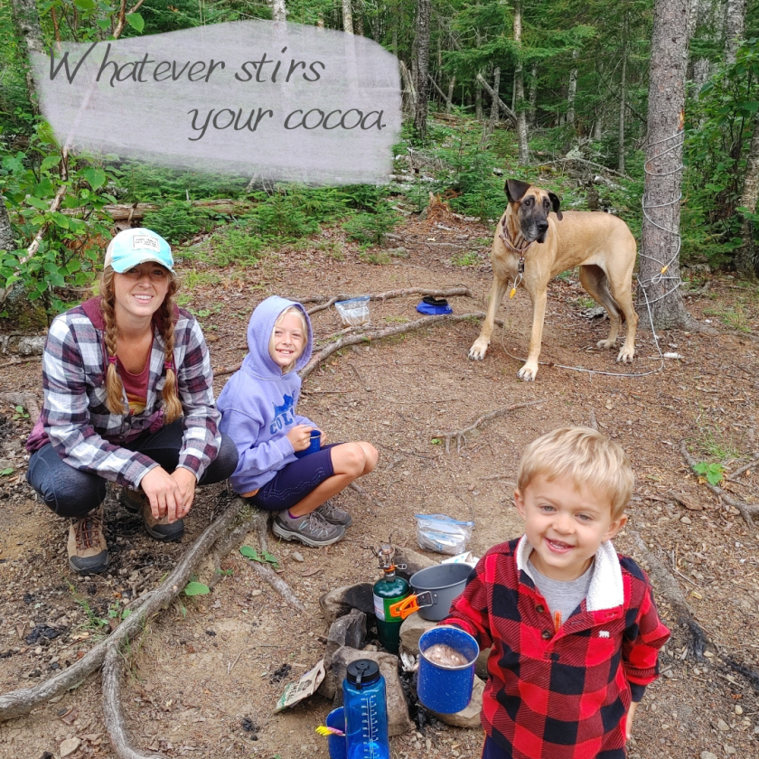
**Note: There are no camping areas at Grand Portage State Park. If you’re interested in camping nearby, try Cascade Falls or George Crosby Manitou.
Parking
Oh Canada! The other side of Pigeon River is Canada. If fact, the parking area is just one left turn before the border. So, if you’ve hit Canada, you’ve gone too far.
The parking area is petite, but we didn’t have trouble finding a spot. The parking area is also close enough to the visitors center and picnic area to bring a lunch and make a day of it.
Visitors Center
Stop in at the visitor’s center before or after your hike to check out the history of the area and Native American information. It’s worth the stop to see the displays. The area is rich in voyager history and Ojibwe culture, also check out Grand Portage National Monument.
Trail Head
The trail starts right at the visitor’s center. The easy to follow and well marked trail with lead the way. Don’t forget to check out the overlook at the beginning of the trail. It’s intriguing to watch the river become more wild the farther upstream you hike.
Terrain
The path to the High Falls is paved, making it stroller and wheel chair friendly. Continuing on the trail to the Middle Falls, however, is not paved and is considered to be a difficult trail.
Given that we had two 10 week old puppies with us, we didn’t tackle the trail to Middle Falls. An adventure for another time, after the dogs gain more experience and stamina.
Pigeon River Banks
Take a side quest on the riverbanks of the Pigeon River. The rocky shore and mini-cascades are worth the pitstop. There are a few turnoffs along the trail. Watch your step and keep little ones in hand. There are no hand rails along the rivers edge once you get down to the shore.
We had a fun time hopping on rocks and exploring the river. The current is strong and water murky, keep kids (and puppies) in sight.
Boardwalk and Steps
Where the pavement ends, the boardwalk begins. All the way up to the falls is wheel chair and stroller accessible. There are a couple of spots with steps for a more grand view of the falls.
The Falls
Stunning!! I am always amazed by waterfall views. Listen to the rushing water before peering over the deck at this cascade. Be mindful of the railings and follow guidelines. Don’t make your attempt at a great picture the last thing you do.
Waterfalls on the Way
Don’t drive all the way to the tip of Minnesota to see just one waterfall! Hit the falls of the North Shore on the way!
Craving a trip to the North Shore but dreading the crowds? Same here! I love the beauty and dramatic landscapes of Minnesota’s North Shore, but those crowds are a huge deterrent. George Crosby is the perfect place to be then.
Distance: 2 Miles Level: Difficult Dog Friendly: Yes, on leash Time to go: Late Spring-Fall Fees:$7 Entrance Fee or $35 Yearly MN State Park Vehicle Pass (totally worth it, get it here.)
Parking
For being a state park with fewer visitors, the parking lot sure stayed full. We didn’t have trouble parking but the lot did seem to always have an abundance of people in it. That being said, we saw very few hikers and campers during our visit. Everyone is very well dispersed.
Middle Trail
Given that there are 24 miles of hiking trails at George Crosby, there are options for getting to the falls. The easiest route is the Middle Trail.
Middle Trail starts at the parking area, there is a clear sign. You’ll pass the pit toilet and continue on until you reach the Manitou River Trail. Once at the Manitou River Trail, take a left. Heading north west, follow the trail to the river bank. The sound of the flowing river can be heard as the trail leads closer to the falls. The hike is really quite simple. Though the terrain can be challenging.
Terrain
The terrain on this trail is not to be taken lightly. There are roots, rocks, steep climbs and descents. It’s really fun! Who doesn’t love a rough trail?! It adds to the adventure. Our four year old traversed this trail with a great attitude and enthusiasm (until it got hot). That being said, I do not recommend this trail for small children or at least have a backpack carrier for the real little adventurers.
Be sure to pack appropriate footwear. We all had our hiking boots/shoes along and definitely needed them. This is not a hike for crocs, leave those in camp or your car. If you have trouble with balance or uneven ground, consider bringing trekking poles or a walking stick.
Unexpected Debris
This is a new one. We saw a wild cooler in it’s natural habitat, haha! It seemed as though someone had just left it and would return shortly. However, on our return trip the cooler was still present and we noticed a broken wheel. We were to curious not to open it, more curious than the bears apparently. The cooler was no longer cool inside, based on the contents of the thawed food items, it had been sitting for a couple of days. You never know what you’ll find on the trail!
Cascade Falls
These falls are absolutely breath taking! The strenuous hike is worth it. Before catching a glimpse of the falls, the rushing water can be heard and it draws hiker in. Watch your footing as you approach the falls. The trail becomes narrow at times with more of a drop than one would like to fall. The rocky edge adjacent to the falls offers plenty of seating the admire the awesome beauty of the falls.
We saw no other hikers on our journey to the falls. This is truly one of the most secluded waterfall hikes I’ve been on in Minnesota. For peace, quiet, and waterfalls, visit the Cascade Falls at George Crosby Manitou State Park.
Venture down to the southeastern tip of Minnesota to Beaver Creek Valley State Park. This whimsical park features an amazing spring fed river with clear waters and trout galore. The trails wind around the valley offering stunning views of the lush hillside and streams.
I was amazed by Minnesota’s bluff country. The dramatic landscapes are amazing. It really proves that Minnesota is beautiful no matter which corner you venture to. It’s not just the North Shore that’s worth a visit.
Hiking Trails & Spring Views
This southern state park hosts only 8 miles of hiking trails. Most of which are contained in the 6+ mile Hiking Club trail. This trail encompasses Beaver Creek Trail, Hole in the Rock Trail, Big Spring Trail, and West Rim Trail. Beaver Creek Valley Trail is the top trail at the park.
Beaver Creek Valley Trail- 3.5 mile loop Plateau Rock Trail-1 mile out & back Hole in the Rock Trail- 1 mile one way Big Spring Trail- .25 miles one way West Rim Trail- 1 mile one way
All of these trails have some kind of river view or creek view. Some of the creeks dry up later in spring and into summer. The river flowing after the spring keeps flowing. Be sure to check out Big Spring Trail for the most tranquil spot in the park, the spring that feeds the river.
Fish for Trout
Fly fisherman enjoy this tranquil stream on a calm morning for fishing brown and brook trout. We are fisherman, but we don’t fly fish. That’s okay, you don’t have to be proficient in fly fishing in order to catch a trout at Beaver Creek. We used our regular fishing rods and some enticing lures. That did the trick!
Combine trout fishing with a hike along the Beaver Creek Valley Trail. There are numerous fishing holes along the way. The largest being at the end of the farthest loop.
Fishing License: All fisherman over the age of 16 must have a fishing license in the state of Minnesota. If you’re fishing in waters with trout, a trout stamp is required.
Camp
Tent, RV, or Hammock! This park has a few options for camping. From an RV area with closer campsites to cart in sites with more tree coverage between, you can choose your seclusion level at Beaver Creek. Sites 27, 34, 38,39, and 42 can accommodate a hammock given the tree size and distance apart. Many of the campsites are near the creek. The sounds of the babbling waters will lull you to sleep… or make you need to visit the restroom.
Birding & Wildlife
Rare migratory birds pass through and nest in the park during the summer months like the warbler and water thrush. Keep a watchful eye while hiking the trails. Wildlife is abundant in Beaver Creek Valley. We watched several deer just off of the trail, spotted several amphibians, numerous birds and an abundant level of trout.
Shrooms and Wildflowers
Don’t rush through these trails. Really slow down and take a look around. These woods are loaded with little treats throughout. There were so many mushrooms on fallen and standing trees. Many were larger than my hand. Wild flowers litter the park in every part, both high and low ground. It’s absolutely stunning to see. We visited in mid-spring, when the flowers are starting to bloom.
Visitor’s Center
At the entrance of the park, the park office includes a petite section of educational items. There are a number of mounted animals, including a timber rattler. It’s a great stop with the kids to check out the local wildlife situation and get a visual what kinds of animals they should be watching for. The rangers also have helpful tips for fishing this area.
Playground
The playground is just off of the main park road on the way to the camping area. Sitting beside the creek, the playground is the perfect spot to romp around and cool off in the cool spring fed waters. If your goal is to play on the park, be sure to hit it early before the sun heats up the metal elements of the equipment.
Just look at that slide, you know that’s burned some cheeks. I can feel the sizzle from my childhood just looking at it. Good times.
Summer is back!! Get your summer bucket list out and ready for some amazing adventures! Make the most of the short Midwest summer and pack as much fun in our 3 warm months of the year.
Camp at a MN State Park
Pitch a tent or park the camper at a Minnesota state park for a summer night in the woods or on the prairie. The Minnesota State Park system has a wide array of camping options to suit all of it’s wilderness lovers. Everything from campground living to densely forested solitude. I prefer the latter. Here are a few options to help narrow down your search:
Hit the trails! Minnesota has no shortage of trails to choose from. Strap on your hiking boots for a winding adventure through Minnesota’s trail system. Trails are scattered all over the state. Minnesota has everything from thru-hike trails to day trip trails. The options are endless but here are a few to get your wheels turning:
Thru-Hike Trails:
Paul Bunyan State Trail (115 miles- Bemidji to Baxter
Superior Hiking Trail (300+ miles- Duluth to Canadian Border)
Minnesota isn’t just 10,000 lakes, she hosts 100+ waterfalls as well. Go chasing waterfalls this summer and soak in their beauty. There are numerous waterfalls along the North Shore of Lake Superior, but there are also falls in other areas of the state. Read on in Waterfalls to See This Summer for more ideas on where to start your chase.
Find your solitude on an unforgettable wilderness experience in the Boundary Waters Canoe Area and Wilderness. One trip to this pristine wilderness will have you craving it’s beauty every summer. We make at least one trip to BWCA every summer. If you’ve been, then you know what I mean. If you’re new and looking for an adventure try Larch Creek to Clove Lake. Clove Lake is a great lake for beginners who want the whole wilderness experience with a short distance to travel.
Paddle Board
Rent a paddle board at a state park or bring your own and enjoy the smooth waters of a summer afternoon. There are twelve state parks in Minnesota that offer paddle board rentals. The going rate is about $10 per hour. Itasca’s rental is through Itasca Sports for $20 per hour or $100 per day.
State Parks offering paddleboard rentals:
Bear Head Lake State Park
Big Bog State Recreation Area
Camden State Park
Glacial Lakes State Park
Glendalough State Park
Itasca State Park *
Lake Shetek State Park
McCarthy Beach State Park
Myre Big Island State Park
Sakatah Lake State Park
Scenic State Park
Split Rock Creek State Park
Stay in a Camper Cabin
Camper cabins are available year-round at Minnesota state parks, but summer means more availability. Some cabins close during the winter due to lack of insulation and heat. During the summer months, all cabins are open and available for reservations. If camping isn’t your style, but you still want to be in the great outdoors, check out these camper cabins for a weekend getaway. Book them asap, they fill up fast!
Visit an Overlook
Climb high above the tree tops on an observation tower or high overlook. For a state that doesn’t have any real mountain peaks, there are some pretty amazing overlooks! Check a few of these off of your list this summer and challenge yourself to climb a fire tower. It’s way more exhilarating than it looks.
Fish For Trout
Southeastern Minnesota is a great area to fish for trout. Get your feet wet in the chilly spring-fed streams where the brown and brook trout make their home. These state parks are known for their awesome fishing streams.
Bring your canoe or kayak on one of Minnesota’s scenic water trails for an overnight camping adventure or day trip. Rent a canoe at a state park for a day. If you’re unfamiliar with canoeing or kayaking, learn how with Minnesota’s “I Can” programs.
State water trails are a great way to see the beautiful natural scenery of Minnesota from the water. Pick a state water trail and launch your canoe/kayak. Here’s a tip, park one vehicle at your designated end point and have someone drop you and your watercraft off at your starting point. This way, you won’t have to paddle against the current to get back to your vehicle. (Don’t miss your exit point!!)
There are numerous state parks offering canoe/kayak rentals across the state. Here are a few great ones to check out:
Bear Head Lake State Park
Glacial Lakes State Park
William O’Brien State Park
Lake Maria State Park
Lake Bemidji State Park
Crow Wing State Park
So many more can be found on the DNR website here…
Berry Picking
Mid-July and early August are peak blueberry times in Minnesota. July is National Blueberry Month, but the season still goes on a couple of weeks into August. Make a day of it by picking blueberries and making blueberry jam, blueberry pie, or toss some in a pancake!
You Pick Blueberry Locations (Check before you go, some locations may be closed for the season)
Visit the MN Arboretum in Chaska, MN. From spring to autumn this everchanging landscape is beautiful to see. With many different facets to the park, there is something for everyone. My grandma enjoys the tulips and other flowers of spring, while I enjoy the maples and evergreens.
Fun Fact: My grandma spent some of her childhood on a farm that is now part of the Arboretum. The house still sits just outside of the borders on the backside of the property. Her family tapped the maples in the park for syrup and they would guide the cows across the road to pasture. When we visit the park, we have our own personal tour guide and get to hear stories of the area from before the U of M Arboretum owned it.
Bike a Railroad Trail
Old railroads turned bike path are the best and easiest places to bike. They are smooth and surrounded by scenic places. The longer trails pass through towns offering a great chance to stop for lunch or an ice cream treat.
MN State Bike Railroad Trails:
Willard Munger (70 miles- Duluth to Hinkley)
Paul Bunyan (115 miles- Bemidji to Baxter)
Root River (42 miles- Fountain to Houston)
Heartland (27 miles- Park Rapids to Walker)
Cannon Falls (20 miles- Red Wing to Cannon Falls)
Visit a Splash Pad
You’ll likely hit the beach a few times this summer. Mix it up and find a splash pad for the kids. Splash pads are popping up all over the place as the new summer fun activity. Some are free, some have a small fee.
Go chasing waterfalls this summer! It’s no surprise that Minnesota is littered with waterfalls all across the state given her reputation for 10,000 lakes. Search far and wide to find your favorite waterfall in Minnesota. Here are a few of our favorites to get you started.
North Shore
Many of Minnesota’s waterfalls are found cascading towards Lake Superior on the North Shore. This makes for a wild getaway weekend of chasing waterfalls all along the stretch of Hwy 61.
Jay Cooke SP
Cross the swinging bridge over the St. Louis River in Jay Cooke state park for phenomenal views of the roaring rapids. The rapids are not tall, but they are wild. The rocky edges on the far side of the bridge give visitors an up close view of the raging river. The hiking trails following the river offer more views of the rock formations jutting out of the river waters.
Warning: Keep kids in hand, do not let them out of your site. The river is powerful and full of rock. The edges of the rocks drop straight into the river. Small children should be held or kept in hand.
Gooseberry is my daughter’s favorite state park. The falls are entertaining all year round. We stop in, at least once, every year. Summer is her favorite time of year to visit, it offers rock hopping at the base of the lower falls.
Park Fees: No Fees Location: Two Harbors, MN
Falls Loop Trail Distance: 1 Mile Type: Loop Terrain: Paved, steps, dirt, boardwalk/bridge Difficulty: Easy Dog Friendly: Yes, on leash
Warning: Be cautious with little ones on the trail. Erosion has caused some of the trails to cave in and slide down. Follow signage for alternative routes and keep small children in hand.
Tettegouche SP
Tettegouche State Park saved us from a disastrous attempt at making it to the Boundary Waters one year in an Accidental Camping Trip. Even though it wasn’t the camping trip we were planning, it turned out to be it’s own adventure. Tettegouche has some of the best scenery in the state. You can’t beat the cliff viewing above Lake Superior, skipping rocks at the mouth of the Baptism River, or the jaw dropping majesty of the High Falls. Tettegouche is a must-see state park for every Minnesotan.
Park Fees: $7 Day Pass or purchase a year-round pass for $35 Location: Silver Bay, MN
High Falls Trail (Two Step Falls can also be seen from this trail) Distance: 3 miles Type: Out & Back Terrain: Dirt/Boardwalk Difficulty: Moderate Dog Friendly: Yes, on leash
Temperance River SP
The Temperance River winds through the forest and rocky ledges of Temperance River State Park. This river has carved it’s path into the stone and through the forest to reach the massive Lake Superior. It’s astonishing to see this river flow. The surrounding hikes are wild with their stone steps and the unique terrain it takes to traverse your way to get a glimpse of the falls passing through it’s gorge.
Park Fees: $7 Day Pass or purchase a year-round pass for $35 Location: Silver Bay, MN
Gorge Trail Distance: .25 miles Type: Out & Back Terrain: Dirt, rock, steps Difficulty: Moderate Dog Friendly: Yes, on leash
Upper Falls Trail Distance: 2 miles Type: Out & Back Terrain: Dirt, rock, steps Difficulty: Moderate Dog Friendly: Yes, on leash
Cascade River SP
The Cascades are absolutely breathtaking. My daughters favorite falls of MN might be Gooseberry, but mine have to the Cascades at Cascade River SP. They wind down to rocks racing toward Lake Superior in such a majestic fashion.
Park Fees: $7 Day Pass or purchase a year-round pass for $35 Location: Lutsen, MN
Cascade River Lower Loop Distance: 1 Mile Type: Loop Terrain: Dirt/Boardwalk Difficulty: Easy (may be slippery in some areas) Dog Friendly: Yes, on leash
Grand Portage Sp
Minnesota’s tallest waterfall roars from the Pigeon River between Minnesota and Canada. Grand Portage isn’t just a cool waterfall spot. The state park shares so much history about the area and contains a lot of cultural information to be absorbed by it’s visitors. The falls can be views from two hikes with two very different terrains.
Park Fees: $7 Day Pass or purchase a year-round pass for $35 (totally worth it) Location: Grand Portage, MN (almost into Canada)
High Falls Distance: 1 Mile Type: Out & Back Terrain: Paved Difficulty: Easy Dog Friendly: Yes, on leash
Middle Falls Distance: 4.5 miles Type: Needle Loop Terrain: Dirt trail, rocky, sometimes slick, drastic elevation change. Difficulty: Strenuous Dog Friendly: Yes, on leash.
Johnson Falls
This waterfall takes a lot more planning, energy, and perseverance to reach. Johnson Falls resides inside the borders of the Boundary Waters Canoe Area & Wilderness. It’s one of the coolest BWCA adventures I’ve been on. If you’re up to tackling the task of visiting this waterfall check out the adventure here.
Southern Minnesota
Not every waterfall trip requires a visit to the North Shore. Check out these southern beauties and explore their astounding surroundings.
Nerstrand Big woods SP
Search for the hidden falls along the Prairie Creek. Along the way, view the rare dwarf trout lily. It only grows in this state park in Minnesota. There are some areas of the trails that are board walked and marked off with a rope. This is to ensure that hikers don’t tread on the rare flower, destroying it’s limited habitat.
Park Fees: $7 Day Pass or purchase a year-round pass for $35 Location: Nearstand, MN
Hidden Falls Trail Distance: 1 mile Type: Loop Terrain: Dirt trail/boardwalk with stairs Difficulty: Easy Dog Friendly: Yes, on leash. Keep pets on trail to protect rare lily.
Pipestone National Monument
This culturally packed trail leads to one of the coolest spots in southern Minnesota. Hiking to Winnewissa Falls is such a whimsical experience. The falls seem so out of place and are absolutely gorgeous!
Park Fees: No Fees Location: Pipestone, MN
Circle Trail Distance: 3/4 mile Type: Loop Terrain: Paved Difficulty: Easy Dog Friendly: Yes, on leash.
Bonus Parks: The Pipestone area has two state parks nearby that are worth a visit: Blue Mounds & Split Rock Creek. We bundled these state parks into our Pipestone adventure for a full weekend of outdoor fun.
Minneopa
Camping, hiking, history, and bison….. Yes, BISON!! Not only does Minneopa have an amazing two-step falls with a spout hurdling it’s way down to a pool and creek, it also has a herd of bison. This park is split into two section. One side holds the tranquil waterfalls and peaceful picnic area. The other has hiking trails and a herd of bison in a 325 acre encloser that visitors can drive right through.
Park Fees: $7 Day Pass or purchase a year-round pass for $35 Location: Mankato, MN
Water Falls Hike Distance: 1/3 mile Type: Out & Back Terrain: Paved Difficulty: Easy Dog Friendly: Yes, on leash.
Our Minneopa adventure has my daughter asking to go back every year now.
If you’re looking for more than just waterfalls, head over to Things to do this Summer in Minnesota. You’ll find ideas to add to your summer bucket list.
Western Minnesota is prairie country. This beautiful vista isn’t what folks usually think of when they think of the great white north, but it’s here and we love our prairies. A visit midsummer offers views of wildflowers, prairie grasses and thriving wildlife.
Paddle Boarding & Rental
Signalness (Mountain) Lake is a petite, yet crystal clear lake perfect for paddleboarding or kayaking. Rentals are available at the park office for $10 per hour. Bring your fishing rod and toss a few casts from your watercraft or the pier. Watch for turtles, they are known to hang around at the end of the pier.
Beach
A small swimming beach is available to cool off in the warm summer sun. The sandy area is perfect for a quick dip. Just around the corner, beyond the reeds is the fishing pier. Check the vegetation line near the shore, there could be critter prints.
Wildlife
Deer, squirrels and many bird species call Glacial Lakes home. The real excitement, we found, was just beneath the surface at the fishing pier. Snapping turtles galore! They popped their heads above the surface to see what’s happening on the dock and submerged once more when we didn’t feed them (please don’t feed the wildlife, even if they’re disappointed). If you’re stealthy enough, you might glimpse a heron as well, we were able to observe one fishing before he took off.
Hiking Trails
This park holds 16 miles of hiking trails through Basswood forest and Southern Minnesota Prairie.
Along with hiking trails, there are 11 miles of Horse trails with an available horse camp. If you prefer to traverse the trails via horseback, this is a wonderful park for you.
Hike the highest point in the park on the High Peak Trail (also the hiking club trail). This 3.6 mile trail is gives visitors the best tour of the park, covering all the landscapes it has to offer.
Camping
Glacial Lakes has numerous camping options to accomidate all different styles of camping. Whether you’re glamping in the campground or rough’n it at a backpack site, Glacial Lakes has you covered. Be sure to reserve your site ahead of time at MN DNR reservation site.
Hike Rolling Hills Trail through scenic pine forests of northern Minnesota. Pond life, wild pine forest, sandy beach, wildlife and serene, uncrowded winding trails.
Moose Lake State Park was always one of those parks that we drove by but never stopped at on our way up to the North Shore. We changed that with a special trip just to visit Moose Lake.
With only 5 miles of hiking trails at Moose Lake, it’s pretty easy to hike them all in one day. We chose to hike the Rolling Hills Trail and then spent the rest of the day at the beach on Echo Lake. No, not Moose Lake.
Distance: 1.5 miles Level: Easy Dog Friendly: Yes, on leash Time to go: Spring-Fall, no groomed trails in the winter. Also, the Agate Center is only open from May-September. Fees:$7 Entrance Fee or $35 Yearly MN State Park Vehicle Pass (totally worth it, get it here.)
Location: 2 mile southeast of the city of Moose Lake Address: 4252 Cty Rd 37, Moose Lake, MN 55767
Trail Head & Visitor’s Center
The trail head begins on the east side of the parking area, opposite the visitor center. It’s pretty obvious with fresh signage. Take a gander at the most adorable pine tree in the forest as you pass. The trail almost immediately comes to a fork, stay to the left, toward the road.
The signs for Rolling Hills trail are really easy to follow. They are clearly fresh and given that this is the Hiking Club trail, they are quite obvious. Follow the signs and they won’t steer you wrong.
Road Crossing
Watch for cars and ATVs. There are chains blocking the trail from vehicle crossings, go around and don’t trip. It’s not often that hikers are asked to cross roads at parks.
After crossing the road, the trail forks again, take a right.
Dams, Ponds, & Pines
The trail passes two small dams on the left. Look for beaver chewed wood and signs of muskrats in the ponds. Tracks and other animal sign can be found around the trails edge by the water.
The pine forest that this trail winds through is simply beautiful. In some areas, there isn’t too much undergrowth which really allows hikers to peer through the trees for a greater distance than other wooded areas with thick underbrush.
Berries & Wildlife
Depending on the time of year you’re visiting, there are berries about the trail. They really added a pop of color in the auburn November landscape. Watching for critters scurrying about trying to stash away food for the winter was great fun. They are hilarious.
Shelter Split
When you’ve reached the shelter, you know you’re at the split in the trail. A great pit stop for a snack or a break from poor weather.
This way or that way? Two trail options meet at the shelter. Turning left will complete the Rolling Hills trail, leading back to the road in .3 miles, making the total hiked miles 1.5. The other option is to continue straight and add on .7 miles to the trail, this is the Wildlife Pond Trail. Both options make a loop leading back to the road crossing.
Echo Lake
Before leaving the park, be sure to check out the trails around Echo Lake, the pier, and beach. This area is filled with wildlife. We watched a pair of eagles soar above the water and found otter tracks. The kids found trees to climb and found the sandy beach most entertaining, even in November.
Refuel
There are a couple of options for a refuel near Moose Lake State Park. The closest being Lazy Moose Grille & Gifts. This cozy joint offers a delicious American menu, fantastic burgers and unique Northwoods gifts.
The next option, if you’ll be passing through Hinkley, MN on the way home, is of course, Tobies. Grab a caramel roll or a donut for the road and don’t forget to grab a wet nap for those gooey fingers.
Go chasing waterfalls this winter. Waterfalls are magnificent! The rushing water cascading over cliffs and crashing to the pool and rocks below is mesmerizing. Seeing all of that in winter is even more so. Something about the thrill of the water fighting through the ice and snow catches our attention. Maybe it’s because we, too, are fighting through the ice and snow.
Bonus: All of these locations are dog friendly on ungroomed trails. No dogs allowed in buildings, but that’s okay. We prefer exploring outdoors anyway.
North Shore
The North Shore is a bustling tourist area during the short summer months here in Minnesota. The calm of winter doesn’t just put a hush over the woods. The crowds dwindle and in some cases are nonexistent, especially on the longer, more strenuous trails. Take advantage of this quiet winter oasis to explore the wintery wonderland of the North Shore state parks.
Jay Cooke
Ski, snowshoe or winter boot hike the swinging bridge and the trails around the falls. Watching the rapids bubble over the ice is intense, watch your step! The ice and snow make the rocky edge a dicey area. The trail across the bridge, along the edge to the St. Louis River is open to hikers and snowshoers. The other trails in the park are intended for skiers. There are 32 miles of ski trail at Jay Cooke. If you like skiing, this is the park for you.
Things to do:
Swinging Bridge
Snowshoe (rentals at visitors center)
St. Louis River Edge- Hiking/Snowshoeing (dog friendly)
Silver Creek Trail- Skiers (not dog friendly)
Camper Cabin Stay (not dog friendly)
Make this park a weekend event by staying in a Cozy Camper Cabin. The cabins at Jay Cooke are heated and oh so cozy. It’s a perfect way to end a day on a wintery trail. Jay Cooke in the winter is amazing!
Gooseberry
Gooseberry is a must anytime you travel to the North Shore. Gooseberry in winter is breath taking! Watch your step on the icy steps and enjoy the stroll from Fifth Falls all the way down to Lake Superior.
Take a snowshoe or boot hike along the Gooseberry River to the Fifth Falls, then hike down stream to the Upper, Middle & Lower falls, There are clear trails along the river. Take it a step further and meander down to the shore of Lake Superior to see the big lake crash against the rocky shore lined with ice. Winter at Gooseberry should be on every Minnesotan’s winter bucket list.
Tettegouche
Adventure along the Baptism River to the frozen falls of Tettegouche State Park. Hiking or snowshoeing is available at the park. One can hike the High falls and the Two Step fall in one go, as they follow along the same trail. The Cascade falls requires a different parking area and separate hike. Very worth the extra effort. It is great fun to hike down to the Baptism River mouth where it reaches Lake Superior. It’s great fun to see if you can skip the wave battered rocks across the water.
Things to do:
High Falls (1.5 mile hike)
Two Step Falls (1.2 mile hike)
Cascade Falls (.8 mile hike)
Shovel Point Overlook (.4 mile hike)
Mouth of River (.25 mile hike)
Visitors Center/Gift Shop
Palisade Head Overlook
Boot Hiking
Snowshoe (rentals in Visitors Center)
Ski (15 miles, difficult)
Park Fees: $7 day pass, or $35 yearly pass. Must be purchased online if park office is closed.
Skiers Be Warned: All trails at Tettegouche are considered difficult unless marked as most difficult. These trails are not for beginners.
Warning: The bridge at the High Falls is closed after flood damage, no crossing allowed.
Cascade River
See the falls encased in ice and snow. The river fighting it’s way to the surface and peaking out occasionally, giving glimpses of the root beer colored river making it’s way to freedom of the open Lake Superior.
Things to do:
Boot Hike/Snowshoe (snowshoe rentals at park office, hours limited)
Cross Country Ski (17 miles)
The Cascades
Cascade Falls
Mouth of Cascade River
Park Fees: $7 day pass, or $35 yearly pass. Must be purchased online if park office is closed.
Use caution along the trails next to the falls and Cascade River. The steps may be slick with ice and snow, don’t need to tumble down the rivers edge. Respect the river and her power.
Grand Portage
Minnesota’s tallest waterfall is just as gorgeous in the winter as it is in the summer. Take a journey to the tip top of the Minnesota border and gaze at this monstrous waterfall at the Canadian border.
Things to do:
High Falls (1 mile total)
Middle Falls (for experienced snowshoers, 4.5 miles total)
Snowshoe (bring your own)
Park Fees: Free, no park pass required at this park.
The High Falls is a short half mile, paved walk to the boardwalk and falls overlook. There are a few vantage points to gain all of the glorious views of this falls and the Pigeon River. You can even wave to Canada on the other side.
The Middle Falls is a more treacherous hike. The total milage being 4.5 miles with rough terrain and steep inclines. During warmer months this hike takes about 3 hours. If attempting this hike in the winter, be prepared and give yourself enough time for the journey before dark.
Southern MN
The North Shore may have the state’s more impressive waterfalls, but it’s doesn’t have all of them. Southern Minnesota has a few falls worth adventuring to this winter.
Nerstrand Big Woods
Just an hour south of the twin cities sits a frozen waterfall waiting for adventurers to seek it’s secrets. Hike the boardwalk to the the Frozen Falls at Nerstrand Big Woods. The hike to the falls is just half a mile, but can easily be made into a mile long loop.
Things to do:
Hidden Falls
Crossing Prairie Creek
Snowshoe Rental (Park Office)
Rustic Playground
Park Fees: $7 day pass, or $35 yearly pass. Must be purchased online if park office is closed.
Minneopa
Minneopa is a great little park for some winter adventure. The small falls is the perfect spot for a picnic and a winter stroll. The bison range is in a separate portion of the park that requires a short drive from the main park office. Minneopa offers candlelit hikes on occasion, watch the events calendar for fun activities. This year’s candlelit hike will be held on February 24th, 2024 at 5pm.
Things to do:
Upper Falls
Lower Falls
Bison Herd
Snowshoe (rentals at park office)
Candlelit Hike (February 24th 2024)
Park Fees: $7 day pass, or $35 yearly pass. Must be purchased online if park office is closed.
Note: The trail to the lower falls is closed due to a cave in and accident. Check the park alerts page before venturing to the park. The falls can be viewed from the upper trail.
Bonus: Pipestone National Monument
Pipestone National Monument is at the southwestern tip of Minnesota. There is so much Native American culture to learn about at this unique monument. The visitors center is a great place to warm up and learn a thing or two about the history of Pipestone National Monument and the people who hold this area sacred.
Things to do:
Circle Trail (.75 miles)
Waterfall viewing
Snowshoe (limited supply available at Visitor’s Center)
Park Fees: Free, no fees at this National Monument.
Hike or snowshoe along the Circle trail. The trail is no longer cleared of snow at the beginning of the new year. The accumulation of snow along the paved path allows for a nice, easy snowshoeing experience along the Circle Trail and passed the waterfall. Be careful on the spur trails, such as the oracle, as the snow and ice may make the steep areas slippery.
Southern Minnesota prairie lands are gorgeous! It’s a different kind of landscape than most Minnesotans are used to. Peel away from the usual thick forests and pine groves for something different.
Distance:3.6 miles Level: Easy Dog Friendly: Yes Time to go: Spring- Autumn is best, open year-round (ungroomed ski) Fees: $7 Entrance Fee or $35 Yearly MN State Park Vehicle Pass (totally worth it, get it here.)
Location: Glacial Lakes is located just 5 miles south of the town of Starbuck, MN. Address: 25022 County Road 41, Starbuck, MN 56381
Trail Head & Parking
Parking is available near the Signalness Lake. The trail head is on the lake side of the parking area, you’ll need to head east (right if you’re facing the lake). This first section of trail leads along the lake to a second parking area that is available for group campers.
Signalness Lake Shore
Hiking along the edge of the lake is beautiful, especially when crossing the bridge over the reeds. Watch for butterflies, frogs, and turtles in this area. Life is abundant!
Passing the Campground
The trail will lead passed a small amphitheater and to the tent camping area. The trail continues south after the campground. It is well marked and very obvious.
Note on Water: This is the last chance for water before heading into the prairie. We filled up our water bottles at the camp area water spigots. Stay hydrated, folks!
Prairie Vistas
It is at this point, beyond the campground, that the trail truly becomes prairie. The tall grasses and wildflowers sway in the wind and welcome bees and butterflies to their nectar. Take your time through this stretch of the trail. We truly enjoyed the long views reaching over the land. The sway of the prairie is tranquil and brings peace to those who take the time to appreciate it.
Entering The Forest
The forest at the edge of the prairie provides much needed shade on a hot July day. Take refuge here before the climb to the highest point in the park. The towering old growth trees are a safe haven from the heat for animals as well. Keep a watchful eye for deer, racoons, and woodpeckers.
Scramble
The parks highest point overlooks ponds, prairie, and farms. To get there, hikers must overcome the incline that crests at this view. This is the only truly steep portion of the trail, and it’s not too bad. It seemed a bit more difficult as I was carrying my 3 year old on my back. The climb is actually very neat, and well maintained. At the top, a bench waits for hikers to take a rest. It’s the perfect spot to unpack a picnic and rehydrate.
Looping Back
The trail loops back through the forest and out to the prairie. It loops once more, giving the option for a hike to a small lake or to continue back on the original trail. We opted to stay on the original trail. It cut off a third of a mile, it was a very hot day and we had paddle boarding to get to!
Other Park Must-Do’s
There is more to do at this park than hike. We spent the whole day here and had a blast.
Canoe, Kayak, Paddle Board (rentals available or bring you own)
Of the 18 miles of hiking trails in the park, the hiking club trail covers the most interesting and most picturesque views in the park. From river views to pine forests, this hike has all the features.
Distance: 2.2 miles
Level: Easy
Time to go: Spring-Autumn
Dog Friendly: Yes, on Leash
Fees: Yearly State Park Pass $35, Daily $7
Parking and Trail Head
Follow the main entrance road all the way to the farthest parking lot. There is a small building available for gatherings and restrooms available.
State Park Pass: Parking passes may be obtained at the park office (if the office is open) upon entering the park or online at the MN DNR website.
The trail begins at the informational stand, there is a map available. The hiking club trail is well marked with small “Hiking Club” signs and there are maps posted throughout the trail.
Two Rivers Meet
Possibly the second most beautiful spot in the park (the first is Chippewa Overlook). See where the two rivers, the Crow Wing and Mississippi, converge. These calm waters come together as one and make their way along the Mississippi to the Gulf of Mexico. Visit in early morning to watch the mist rise off the water. Wait quietly and long enough, you may just see a beaver or muskrat working along the rivers edge.
Old Crow Wing Village
The old town once catered to travelers and fur traders on the river. When the railroad passed through Brainerd, the town fizzled out and was abandoned. A little spooky, but so neat! Check out the old building and boardwalk. It’s a neat splash of history in the forest. There are signs posted in the area describing what kind of building and business stood in different locations in the area.
Ox Cart Trail
The Ox Cart Trail is part of the hiking club trail and travels the path that was used for ox carts, imagine that! The trail leads along the riverbank of the Mississippi and is part of the hiking club trail. You won’t need to watch for ox droppings these days though, but do check out the spot where they crossed the river.
Chippewa Lookout
The most beautiful and picturesque location in the park. If you don’t have the the time to hike the entire hiking club trail on your visit, you can access this overlook by parking at the boat ramp access on the Mississippi. It’s so worth the hike though. There is a set of steps leading up to the overlook from the access. If hiking, there is a slight incline giving views of the Mississippi along the way.
Church and Grave Markers
An old, restored church stands in a small clearing in the pine forest. There is a memorial and burial sites. This eerie resting place is actually a quite peaceful place along the hike.
Also Check Out:
Paul Bunyan State Trail: The Paul Bunyan State Trail encompasses 115 miles of paved bike trail. This trail runs from Bemidji State Park to Crow Wing State Park. The trail begins or ends at Crow Wing, depending on which direction one is heading. It’s neat to see a section of this long trail.
Say “Hi” to Paul: Zip across MN-371 after visiting the park to say “Hello” to Paul Bunyan. Paul is waiting outside of the area visitor’s center to greet visitors. A great spot for a photo in Minnesota.
Wildlife: Slow down and observe the wildlife in the park. Search for tracks along the riverbank, watch the chipmunks and squirrels, there are a number of animals who call this park home.